A paper map is not a backup for when your GPS fails; it is a primary tool for strategic terrain intelligence that a screen can never offer.
- GPS provides a tactical route, but a map reveals the landscape’s logic, allowing you to anticipate hazards and opportunities.
- Physical map skills like reading contour lines and marking routes are proactive survival tools, not reactive measures.
Recommendation: The professional approach combines digital tools for pre-trip planning with a physical map for in-field execution and strategic decision-making.
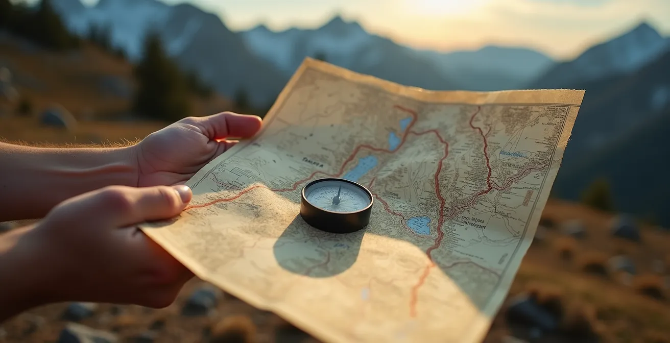
You feel it in your pocket, that sleek rectangle of glass and silicon. It’s your guide, your oracle, your infallible link to the satellite gods. You scoff at the faded, folded relics of the past. A paper map? That’s for grandfathers and lost tourists. Your confidence is absolute, right up until the moment the screen goes black. Or worse, the blue dot begins to drift, untethered, in a blank void labeled “No Signal.” Panic, cold and sharp, begins to set in. This is the moment every modern traveler fears.
The common wisdom says a map is a backup for when your battery dies. This is true, but it misses the entire point. It frames the map as a tool of last resort, a primitive failsafe. This thinking is a trap. It assumes the digital way is superior until it breaks. The fundamental failure of GPS isn’t when it stops working; it’s the critical information it hides from you when it *is* working. It funnels your entire world down to a single, glowing line, robbing you of context, understanding, and true orientation.
The real case for the paper map has nothing to do with batteries. It is about reclaiming a superior form of awareness: terrain intelligence. It is about shifting from a passive passenger following a digital command to an active navigator who understands the land itself. This is not about nostalgia; it is about survival, strategy, and a more profound connection to the world you move through. This guide will not teach you to merely survive technology’s failure, but to transcend its limitations from the very start.
To master the landscape, you must first understand the tools that reveal its secrets. This article breaks down the essential skills and strategic mindset required to turn a simple sheet of paper into your most powerful navigational asset.
Summary: A Navigator’s Guide to Paper Maps
- Why Paper Maps Help You Understand the Region Better Than Screens?
- How to Read Contour Lines to Predict Steep Hills?
- Laminated Atlas or Fold-Out Map: Which Survives Coffee Spills?
- The “No Signal” Panic That hits 90% of GPS Users
- How to Mark Your Route With Highlighters for Quick Reference?
- Why Relying on GPS Near Rocks Is a Dangerous Gamble?
- When to Start Your Hike to Have the Trail Entirely to Yourself?
- How to Use Modern GPS Apps to Outsmart Traffic and Traps?
Why Paper Maps Help You Understand the Region Better Than Screens?
A GPS screen is a window. A paper map is a doorway. The screen shows you the next turn, the next street, the next few miles of a pre-determined path. This is the digital funnel; it narrows your perception to a single objective, and extensive research on GPS dependency shows this erodes our broader spatial awareness. You stop looking at the shape of the hills or the direction of the river. You just follow the line. This passive consumption of data makes you a passenger in your own journey, not a pilot.
Unfolding a paper map forces a complete shift in mindset. You are presented with the entire region at once—all the possibilities, all the relationships. You see how the river valley connects to the mountain pass, how the network of secondary roads offers escape routes, and how your destination sits in context with the entire landscape. This is the foundation of strategic navigation. It allows you to think five steps ahead, to ask “what if?” and to build a mental model of the area that is independent of any single, fragile piece of technology.
This “big picture” view is not a trivial feature; it is the core of real orientation. By seeing everything simultaneously, your brain begins to recognize the landscape’s logic. You see that ridges connect high points and that streams converge to form rivers. You internalize the scale and distance between landmarks. This active engagement builds a robust, internal compass that a screen, with its constant scrolling and zooming, can never replicate. You are no longer just locating a point; you are understanding a place.
How to Read Contour Lines to Predict Steep Hills?
If a map is a language, then contour lines are its grammar. These elegant, flowing lines are what elevate a map from a simple diagram to a three-dimensional story of the land. A GPS tells you where to turn; contour lines tell you what you will face when you get there. Each line represents a specific, constant elevation. By learning to read the spacing between them, you can accurately visualize the terrain before you ever take a step.
The principle is simple: the closer the lines are to each other, the steeper the terrain. Lines that are far apart indicate a gentle, almost flat slope. As they draw nearer, the incline increases. When they are so close they almost touch, you are looking at a cliff or a very steep wall. This is not abstract information; it is actionable intelligence. It tells you where you will expend the most energy, where a slip could be dangerous, and where you might find a less strenuous alternative route your GPS would never suggest.
This table breaks down the relationship between contour line spacing and the reality on the ground. Understanding this is fundamental to planning a route that matches your energy levels and equipment.
| Contour Spacing | Terrain Type | Hiking Difficulty | Energy Required |
|---|---|---|---|
| Lines far apart (>5mm on map) | Gentle slopes | Easy walking | Low – sustainable pace |
| Lines moderately spaced (2-5mm) | Moderate incline | Steady climbing | Moderate – regular breaks needed |
| Lines very close (<2mm) | Steep slopes | Strenuous climbing | High – frequent stops required |
| Lines touching or merged | Cliffs/drops | Impassable terrain | Requires technical equipment or detour |
Mastering this skill transforms you from a trail-follower into a terrain-reader. You can anticipate a grueling climb long before you see it, identify a flat area for a potential campsite, and spot the saddle between two peaks that offers the path of least resistance. This is proactive navigation, the art of making decisions based on foresight, not fatigue.
Laminated Atlas or Fold-Out Map: Which Survives Coffee Spills?
A map’s intelligence is useless if the medium itself fails. The modern traveler, accustomed to indestructible screens, often forgets the physical vulnerability of paper. A single rainstorm, a careless coffee spill, or the constant friction of folding and unfolding can render a standard map illegible in hours. Choosing the right map format is as critical as knowing how to read it. Your choice depends on the mission: a cross-country road trip has different demands than a week-long trek through the mountains.
The classic road atlas is excellent for vehicle-based travel, offering broad coverage and detail in a protected, book-like format. Its weakness is its bulk and susceptibility to moisture. For day hiking or frequent reference, a laminated fold-out map is a superior tool. It resists water, tears, and dirt, and can be marked up with a dry-erase pen. For the ultralight backpacker, custom-printed maps on synthetic materials like Tyvek offer the ultimate in durability and light weight, surviving complete submersion and extreme temperatures.
The evolution of map materials is a direct response to field-tested failure. For example, a case study from Rand McNally shows their development of laminated maps was driven by feedback from professional drivers and outdoorsmen. Their field tests proved laminated versions lasted 10 times longer than paper under daily use. The material must match the environment.
| Map Type | Best Use Case | Durability | Portability | Cost |
|---|---|---|---|---|
| Laminated Fold-out | Day hiking, frequent reference | Waterproof, tear-resistant | Compact when folded | $15-25 |
| Road Atlas | Vehicle travel, trip planning | Moderate, needs protection | Bulky, stays in vehicle | $20-30 |
| Waterproof/Tyvek Custom Print | Ultralight backpacking | Extremely durable, foldable | Ultra-lightweight | $25-35 |
| Standard Paper Map | Home planning, backup | Low, needs lamination/sleeve | Light but fragile | $8-12 |
Ultimately, a fragile map is an unreliable one. Investing in a durable, waterproof map isn’t a luxury; it’s a fundamental part of a professional navigation toolkit. It ensures your most critical intelligence source will be there when you need it most, regardless of the conditions.
The “No Signal” Panic That hits 90% of GPS Users
The panic that sets in when you lose your GPS signal is not just about being lost. It’s a symptom of dependency. The modern navigator has outsourced the fundamental skill of orientation to a device, and when that device falters, they are left with a terrifying void. This dependency is subtle and pervasive. An insurance company survey found that even 77% of drivers who consider themselves safe admit to being distracted by their navigation screens. We are conditioned to trust the screen more than our own senses.
When the signal disappears, the unprepared traveler’s mind races. Where was my last known position? Which way was I heading? The world, once filtered through a reassuring digital interface, suddenly becomes an intimidating and hostile unknown. This is the moment where poor decisions are made. But for the prepared navigator, this moment is not a crisis. It is simply a signal to switch from one tool to another.
The antidote to panic is a protocol. Instead of frantic guesswork, the trained navigator relies on a simple, methodical procedure. This turns a moment of high stress into a calm, problem-solving exercise. Knowing exactly what to do first, second, and third is the key to maintaining composure and control of the situation.
Your Action Plan: The S.T.O.P. Protocol for Signal Loss
- Stop: Immediately cease forward movement the moment you realize you have lost your signal or are unsure of your position. Continuing on blindly is the fastest way to compound an error.
- Think: Recall your last known confirmed position. How long have you been traveling since then? At what speed? This helps you estimate your current location within a “circle of uncertainty” on your map.
- Observe: Look for visible landmarks around you—a distinctive peak, a river bend, a power line. Compare these features to what you see on your paper map to re-orient yourself.
- Plan: Once you have a confident fix on your position, use your map and compass to plot a clear, safe route forward. Do not move again until you have a plan.
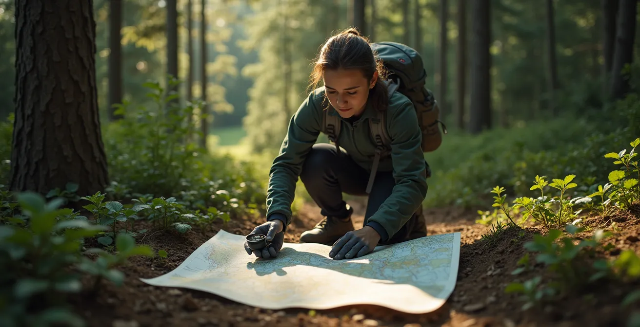
How to Mark Your Route With Highlighters for Quick Reference?
A clean map is an unused map. A true working map is a document, marked with the story of your journey and your plans. Using highlighters and pens to annotate your map before and during a trip transforms it from a static reference into a dynamic dashboard for your expedition. This isn’t random doodling; it’s a systematic way to embed your strategy directly onto the map, making critical information available at a glance.
Professional guides have developed standardized systems for this. A well-known example comes from wilderness guide Andrew Skurka, whose color-coding method is a model of clarity. This system isn’t just about tracing your path; it’s about embedding contingency plans and critical data directly into the visual field. For instance, by marking escape routes in a different color, you are constantly reminded of your options if conditions change. Writing down compass bearings for tricky junctions removes ambiguity when you’re tired or disoriented.
Adopting a professional marking system is a simple step that yields a massive return in efficiency and safety. You can develop your own, but a good starting point is to use a multi-color method to differentiate key features of your plan.
- Primary Route (Yellow): Use a yellow highlighter to trace your intended primary route. It’s bright but transparent enough that you can still see the details underneath.
- Alternate/Escape Routes (Pink or Orange): At key decision points, use a different, vibrant color like pink to mark your bailout options or secondary routes.
- Water Sources (Blue): Circle all known water sources in blue. Add a question mark or note if their reliability is seasonal or unknown.
- Known Hazards (Red): Use a red pen to circle or “X” out known hazards like difficult river crossings, areas of exposure, or impassable terrain.
- Add Key Data (Waterproof Pen): In the margins or at key junctions, write down critical information: estimated times between points, compass bearings for non-obvious turns, and emergency contact numbers.
This annotated map becomes your master document. In a whiteout or a moment of stress, you don’t need to interpret complex data; you just need to follow the yellow line or divert to the pink one. It offloads cognitive strain from your brain onto the paper, freeing you to focus on the immediate environment.
Why Relying on GPS Near Rocks Is a Dangerous Gamble?
One of the most insidious failures of GPS occurs in the very places where you need it most: canyons, dense forests, and mountainous terrain. This is not a failure of the satellites, but a fundamental limitation of how the signals travel. Your GPS receiver needs to “see” multiple satellites to triangulate your position accurately. In environments with large obstructions like cliffs or tall buildings, signals can be blocked or, more dangerously, they can bounce.
This phenomenon is known as multipath error. A signal from a satellite bounces off a rock face before it reaches your receiver. Your device, not knowing any better, calculates your position based on this longer, delayed signal path. The result is a false position that can be dangerously misleading. Extensive research on GPS accuracy in challenging terrain reveals that these errors are not trivial; they can range from 7 to over 50 meters. That’s more than enough to place you on the wrong side of a ridge or at the edge of an unseen cliff.
A fascinating case study from technology company u-blox demonstrates this by drawing a parallel between wilderness canyons and “urban canyons.” Their studies show that GPS accuracy plummets in dense cityscapes as signals bounce off buildings. The exact same physics apply in the wild. As their dual-band testing confirms, these bounced signals can cause a receiver to calculate a position that is off by dozens of meters. A paper map, by contrast, is immune to this deception. It shows the terrain as it truly is. By comparing the map to the visible landscape, a skilled navigator can achieve a far more reliable position fix than a compromised GPS unit.
Relying solely on a GPS in a canyon is a gamble. You are betting that every signal your device receives is a clean one. A paper map and compass make no such assumptions. They rely on the stable, physical geometry of the earth, a far more trustworthy foundation for life-and-death decisions.
When to Start Your Hike to Have the Trail Entirely to Yourself?
Beyond survival and basic orientation, a paper map is a tool for strategy and creativity. It can help you achieve goals your GPS would never consider, such as finding solitude in an otherwise crowded wilderness. Most hikers are funneled by their GPS apps to the same primary trailhead, starting at the same predictable time, and following the same popular loop. They are, in effect, creating a human traffic jam. A map allows you to see the system and outsmart it.
By studying a detailed topographic map, you can identify alternative access points that digital routing algorithms ignore. Look for forest service roads, secondary parking areas, or connecting trails that offer a different entry into the same trail system. Another powerful strategy is to hike a loop trail in the “reverse” direction of the typical flow of traffic. The map reveals the entire system, allowing you to plan a route that intentionally avoids the human tide.
One veteran hiker shared a perfect example of this strategy in practice: “I discovered that by studying paper maps instead of just following GPS suggestions, I could identify lesser-known trailheads that aren’t the default starting points. Last month in Pennsylvania, my paper map showed a forest service road accessing the same trail system from the opposite side. While dozens of cars packed the main trailhead, I had the entire trail to myself by starting from this alternative access point that GPS apps don’t typically route to.” This is the essence of map-based strategy—using superior information to achieve a superior experience.
You can also use the map to target mid-trail highlights. Most people hike to a specific waterfall or viewpoint and then turn back. By identifying scenic spots located deep within a trail network, you can enjoy similar beauty without the crowds. This requires the “big picture” view that only a full map provides.
Key Takeaways
- A paper map’s primary value is providing strategic “terrain intelligence,” a holistic understanding that a GPS screen cannot deliver.
- Physical map skills, like reading contour lines and systematically marking routes, are proactive survival tools that prevent crises rather than just reacting to them.
- The expert approach is not “paper vs. digital,” but a hybrid system: use digital tools for planning and reconnaissance, but rely on an annotated paper map for in-field execution and strategic decisions.
How to Use Modern GPS Apps to Outsmart Traffic and Traps?
The argument is not to abandon digital tools but to put them in their proper place. A GPS is a phenomenal tactical tool. It’s excellent for a quick position fix, for tracking your exact mileage, or for navigating complex road networks in a city. The trap is believing it is a strategic tool. The most advanced navigators operate on a hybrid model: “Digital Recon, Analog Execution.”
This professional workflow, demonstrated by guides like Andrew Skurka, uses the best of both worlds. The process begins at home, using powerful digital mapping software like CalTopo. Here, you can overlay satellite imagery, check recent trip reports from other hikers, and plot multiple potential routes. This is the reconnaissance phase, where you gather as much intelligence as possible. But the crucial step comes next: you print this customized, data-rich map on waterproof paper. This printout becomes your master plan for the field.
In the field, the paper map is the primary tool for strategic decision-making. The GPS on your phone or watch is used sparingly, perhaps once every hour, for a quick, precise coordinate check. You then plot that coordinate onto your paper map. This allows you to see your exact tactical position within the broader strategic context of the entire region. If all electronics fail, the expedition continues uninterrupted, because everyone is operating from the same master document. As data scientist Meredith Broussard wisely notes in her book, Artificial Unintelligence:
Instead of arguing whether paper or digital is a better map interface, people should consider what map is the right tool for the task.
– Meredith Broussard, Artificial Unintelligence: How Computers Misunderstand the World
This is the ultimate answer. The GPS is the right tool for finding your current address. The paper map is the right tool for understanding the entire neighborhood, its risks, and its opportunities. Using both in their proper roles is the key to becoming a truly competent and resilient navigator.
The next step is not to throw away your phone. It is to acquire a quality, waterproof map of your next destination, a compass, and a set of highlighters. The real work of navigation—the work of understanding—begins now.