In summary:
- True navigational safety isn’t about replacing electronics, but about developing a mindset of constant cross-validation.
- Mastering tides, charts, and visual references transforms you from a passenger of technology to a commander of your vessel.
- Developing a “big picture” mental model of your environment is a skill that screens cannot teach and paper charts excel at.
- Regularly practicing non-electronic techniques is the only way to ensure you are prepared for inevitable equipment failure.
The soft glow of the GPS plotter has become a comforting, almost hypnotic presence on the modern bridge. It offers a precise position, a clear route, and a seductive sense of certainty. For many boating enthusiasts, navigating coastal waters has become synonymous with following a magenta line on a screen. This reliance, however, breeds a dangerous complacency. We trust the pixels implicitly, forgetting that they are a representation of reality, not reality itself. What happens when the screen goes dark, the signal is lost, or the underlying chart data is subtly wrong?
The common answer is to have “backups”—a spare GPS, a phone app, or a dusty paper chart in a locker. But this misses the fundamental point. The true art of safe coastal navigation is not about having a backup plan; it’s about cultivating a continuous state of situational awareness that technology can assist but never replace. It’s about developing a predictive mindset, constantly asking “what if?” and using the physical world as your primary source of truth. This is not about abandoning modern tools, but about building the skills to question them, verify them, and operate confidently without them.
This guide moves beyond the simple advice to “carry a compass.” We will deconstruct the core principles of non-electronic navigation, focusing on how to build a robust mental model of your environment. You will learn to work with natural forces like tides, interpret the language of navigational aids, and use your senses to create a rich, three-dimensional understanding of your position and the hazards around you.
To navigate this topic effectively, this article is structured to build your skills progressively. From understanding the limits of GPS to mastering the art of anchoring, each section provides the essential knowledge to transform your approach to coastal seamanship.
Summary: A Mariner’s Guide to Navigating Beyond the Screen
- Why Relying on GPS Near Rocks Is a Dangerous Gamble?
- How to Time Your Passage to Use the Tide Instead of Fighting It?
- Day vs. Night Coastal Sailing: Is the Risk Worth the Experience?
- The Marker Mistake That Leads Boats Into Shallow Water
- Where to Drop Anchor to Ensure You Don’t Drift Overnight?
- Why Paper Maps Help You Understand the Region Better Than Screens?
- When to Start Your Hike Back to Avoid Getting Trapped by the Tide?
- Why You Still Need a Paper Map in the Age of GPS?
Why Relying on GPS Near Rocks Is a Dangerous Gamble?
The primary paradox of modern GPS is that its incredible accuracy can foster a false sense of security. While technology has seen an impressive 30% reduction in signal error to approximately 30cm, this number is dangerously misleading for the coastal navigator. The dot on your screen represents your antenna’s position with remarkable precision, but it says nothing about the accuracy of the chart it’s projected onto. Chart datum errors, survey inaccuracies from decades past, and the simple fact that your boat has a beam and draft mean that a “safe” position on screen can be meters away from disaster in reality.
This is where the principle of cross-validation becomes a non-negotiable rule. Your GPS is just one input among many. In rock-strewn waters, you must constantly verify its data against other, more tangible sources. Is the depth sounder reading consistent with the charted depth? Do the visual landmarks—a lighthouse, a headland, a prominent tower—line up with the bearings shown on the chart from your purported position? A discrepancy between these sources is a critical red flag indicating that either your GPS position is compromised or, more likely, the chart itself is inaccurate.
Relying solely on a plotter creates a “keyhole effect,” where your attention is narrowed to a small screen, divorced from the expansive reality outside. A skilled navigator’s gaze is constantly shifting: from the chart to the water, to the shoreline, to the instruments, and back again. This continuous loop of observation and verification builds a true, high-fidelity mental model of the environment, something a single electronic source can never provide. Near hazards, the most important navigational tool is a healthy sense of skepticism toward your electronics.
How to Time Your Passage to Use the Tide Instead of Fighting It?
For the coastal mariner, the tide is not merely a change in water level; it is a powerful engine of horizontal water movement known as tidal current or stream. Fighting against this current is a frustrating, fuel-guzzling endeavor. Learning to use it, however, is like having a free, predictable push in the right direction. A predictive mindset is essential here; you must plan your passage not for where you are now, but for where the water will be moving when you arrive at critical points in your journey.
The key to this is understanding tidal information before you leave the dock. A tidal atlas is an invaluable tool, providing a graphical representation of the direction and rate of tidal streams for each hour of the tidal cycle. By consulting the atlas, you can time your departure to ensure you have a favorable current carrying you through narrow channels or around headlands. This single planning step can cut hours off a passage and dramatically increase your margin of safety.
While an atlas gives you the big picture, you must verify its predictions with real-world observations. Does the flow of water around a buoy match the direction shown in the atlas? Are moored boats all pointing in the same direction, indicating the prevailing current? Combining these methods builds a robust understanding of the tide’s behavior.
This comparative table shows how different methods for tidal planning can be used together to create a comprehensive picture of the tidal situation. Each has its own strengths, and a good navigator knows when to apply each one.
| Method | Accuracy | Equipment Needed | Best Use Case |
|---|---|---|---|
| Rule of Twelfths | ±0.5ft | Tide tables, watch | Calculating intermediate heights |
| Tidal Atlas | High | Atlas, parallel rules | Planning favorable current routes |
| Natural Indicators | Moderate | Visual observation | Real-time verification |
| Depth Sounder | Very High | Electronic sounder | Immediate depth confirmation |
By mastering these techniques, you shift from being a victim of the tide to being its partner. This is a core skill that separates the novice from the seasoned coastal navigator, turning a potentially arduous slog into an elegant and efficient passage. The tide is one of the most powerful and predictable forces in coastal waters; ignoring it is a critical mistake.
Day vs. Night Coastal Sailing: Is the Risk Worth the Experience?
Sailing at night transforms a familiar coastline into an entirely new world. Distances become deceptive, landmarks disappear, and the sea takes on a mysterious, sometimes intimidating, character. For many, the added risk is not worth the anxiety. Yet, for a prepared navigator, a night passage is not only a profound experience but also an essential training ground for honing non-visual skills. It forces you to engage in sensory navigation, relying on sound, feel, and the rhythmic language of lights to maintain situational awareness.
The primary challenge is the loss of visual cues. Headlands, bays, and even entire islands merge into a single, dark mass. Your world shrinks to the compass light and the patterns of navigational aids. This is where meticulous planning becomes paramount. Before nightfall, you must have a clear passage plan, with expected timings for passing key lighthouses and buoys. Their unique characteristics—the color and sequence of their flashes—become your primary means of confirming your position.
Embracing night sailing also develops a deeper connection to the vessel and the environment. As Andrew Burton of Cruising World Magazine notes, there is a deep satisfaction in this traditional practice:
Practicing some of the more traditional forms of coastal navigation is a good mental exercise, and personally, it makes me feel like quite the old salt when I haul out the hand-bearing compass.
– Andrew Burton, Cruising World Magazine
Success at night depends on preparation and discipline. Protecting your night vision by using red light in the cockpit and below decks is not just a suggestion; it is a critical safety procedure. A single flash of white light can ruin your low-light sensitivity for up to 30 minutes. To truly master night navigation, you must learn to trust your other senses and practice interpreting their signals.
Your Action Plan: Night Navigation Sensory Adaptation
- Preserve night vision by using red lights only and avoiding white light exposure for 30 minutes before watch.
- Listen for wave patterns on shores; changes in echo can indicate proximity to cliffs or structures.
- Monitor the lean of moored boats and direction of water flow around buoys to verify tidal information.
- Time lighthouse flash sequences with a stopwatch to identify your position from their characteristic patterns.
- Feel changes in sea state through the deck to detect shallow water or the boundaries between different currents.
The Marker Mistake That Leads Boats Into Shallow Water
Navigational markers—the buoys and beacons that line our channels—are the road signs of the sea. They seem simple enough: red and green shapes that guide you into port. However, a fundamental misunderstanding of this system is a common and dangerous mistake that leads countless boats into shallow water. The error stems from not knowing which internationally recognized buoyage system is in effect for your region.
The world is divided into two main regions by the International Association of Lighthouse Authorities (IALA). While both use red and green, their meaning is reversed. In IALA Region B (which includes the Americas, Japan, and the Philippines), the rule is “Red, Right, Returning.” This means you keep red markers to your starboard (right) side when returning from sea. In IALA Region A (covering the rest of the world, including Europe, Africa, and Australia), the rule is the opposite: you keep green markers to starboard when returning from sea.
This difference is not a trivial detail; it is a critical piece of local knowledge. A navigator accustomed to one system who sails into the other without awareness is at high risk of making a catastrophic error, turning into a channel on the wrong side of a marker and running aground. This is a classic example of where a GPS plotter can be misleading; it shows you the marker, but it doesn’t shout a warning that the rules you are used to have been reversed.
Case Study: The IALA Buoyage System Trap
The International Association of Lighthouse Authorities (IALA) maintains two distinct buoyage systems. Region A (Europe, Africa, Asia, Australia) keeps red markers to port when entering from seaward, while Region B (Americas, Japan, Philippines) follows ‘red right returning.’ This fundamental difference has caused numerous grounding incidents when sailors cross between regions without adjusting their navigation habits, highlighting the danger of assuming universal rules in a regionally divided system.
Before entering any new coastal area, it is your absolute responsibility as a navigator to confirm which IALA region you are in. This information is clearly stated on the pilot charts and in cruising guides for the area. Assuming the rules are the same as your home waters is a gamble you cannot afford to take. True situational awareness means not just seeing the markers, but understanding the specific grammar of the system you are navigating within.
Where to Drop Anchor to Ensure You Don’t Drift Overnight?
Dropping anchor is not the end of a navigational challenge; it is the beginning of a new one. A dragging anchor in the middle of the night, especially in a crowded anchorage with a rising wind, is one of the most stressful situations a boater can face. According to P&I club statistics, a surprising 10% of navigational claims are related to anchoring incidents, proving that this seemingly simple task is fraught with risk. The key to a secure night’s sleep is a combination of meticulous preparation, careful site selection, and active monitoring.
Your first task is to assess the seabed, or “holding ground.” A chart will give you an abbreviation (e.g., M for mud, S for sand, R for rock), but this is only a guide. The traditional method of using a lead line with a tallow-filled cup to bring up a sample of the bottom is still an invaluable technique. Good holding is found in sand or mud; poor holding in rock, kelp, or very soft silt. Dropping anchor without knowing what’s underneath is pure guesswork.
Once the anchor is down and you’ve paid out sufficient scope (the ratio of anchor rode length to water depth), the work of cross-validation begins. Immediately take bearings on two or three fixed objects on shore. These can be lighthouses, towers, or even prominent trees. By monitoring these bearings, you can detect even the slightest drag long before your GPS anchor alarm sounds. A change in the bearings means you are moving. This simple, non-electronic technique is the most reliable form of anchor watch.
Even advanced technology recognizes the complexity of this problem. In a fascinating application, researchers have developed machine learning models to predict anchor dragging risk, confirming the many variables at play. While this technology is not yet on the average cruiser’s boat, it underscores the importance of the factors we can control: choosing the right spot, using enough scope, and, most importantly, keeping a vigilant watch through both electronic and traditional means.
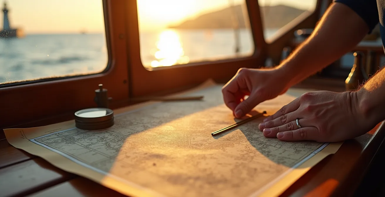
Why Paper Maps Help You Understand the Region Better Than Screens?
In an age dominated by interactive screens, the humble paper chart can seem like a relic. Yet, for developing a deep, strategic understanding of a coastal area, it remains a superior tool. The limitation of a GPS plotter is its “keyhole” view. We are constantly pinching, zooming, and scrolling, seeing only a small fraction of the overall area at any given time. This fragmented perspective makes it difficult to build a cohesive mental model of the region.
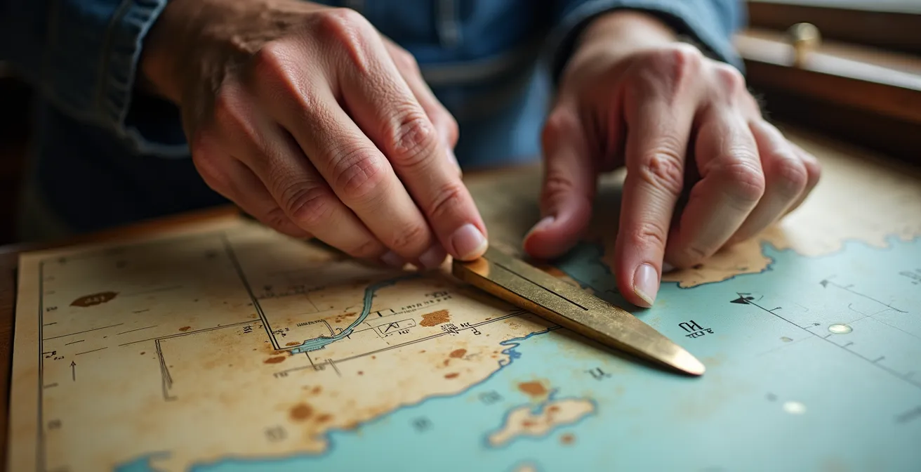
A paper chart, by contrast, presents the entire area in a single, fixed view. Its large format forces your brain to process the relationships between distant points: the bay you are leaving, the headland you must round in three hours, and the harbor you will enter at sunset. You see the whole journey at once. This “big picture” view is crucial for strategic planning, allowing you to anticipate challenges and opportunities long before they appear on a small screen. It encourages a proactive, predictive mindset rather than a reactive one.
This cognitive benefit is not just a romantic notion; it is a recognized principle among navigation experts. The act of physically plotting a course with a pencil, dividers, and parallel rules engages different parts of the brain, cementing the information more effectively than simply tapping a screen.
The large, fixed format of a paper chart forces the brain to build a strategic, big-picture mental model of the entire region, something lost when endlessly pinching and zooming on a screen.
– Marine Navigation Expert, Cruising World Navigation Guide
Furthermore, a paper chart is a master document. It can be annotated with local knowledge, tidal information, and passage notes, creating a single, comprehensive resource for your voyage. It is not just a map; it is an active workspace. While a GPS is an excellent tool for tactical, minute-to-minute positioning, the paper chart remains the undisputed champion of strategic, long-range planning and deep regional understanding.
When to Start Your Hike Back to Avoid Getting Trapped by the Tide?
Coastal hikers face a similar, and often more immediate, threat from the tide than boaters do. Their principles for avoiding being trapped on a beach or a causeway by rising water offer a powerful lesson in tidal awareness that every mariner should master. This is especially true when planning shore excursions with a dinghy or tender. A beautiful, secluded beach at low tide can become a watery prison in a matter of hours, leaving your tender high and dry or, worse, swamped by the incoming sea.
The first step, borrowed directly from the coastal hiker’s handbook, is to identify the “squeeze point”—the lowest or narrowest part of your escape route. For a boater, this might be the sandbar you crossed to enter a lagoon or the dinghy landing at the base of a steep beach. Before you relax and explore, you must determine the time of high water and, more importantly, the time at which that squeeze point will become impassable. This requires applying methods like the Rule of Twelfths to estimate the water height at any given hour.
Visual cues are your most reliable real-time indicators. As soon as you land, make a mental note of the “wrack line”—the line of seaweed and debris that marks the high-water point from the previous tide. This is your danger zone. A simple but effective technique is to place a stick at the water’s edge and check its position every 15-20 minutes. This creates a simple, no-tech tide clock that provides undeniable evidence of the water’s advance.
The crucial calculation is your “turn-around time.” Just like a mountaineer respects the summit turn-around time to avoid being caught in darkness, a coastal explorer must respect the tide. Calculate how long it will take to return to your tender and get underway, then add a generous safety buffer—at least one hour. Your departure from the beach should be dictated by the clock and the tide, not by a whim. This disciplined approach, learned from those who navigate the coast on foot, is a vital skill for safe and stress-free exploration by sea.
Key takeaways
- Navigational safety is a state of mind, not a piece of equipment. Cultivate skepticism and always cross-validate your data.
- The physical environment—tides, landmarks, seabed, lights—is your primary source of truth. Electronics are secondary.
- A paper chart’s “big picture” view is essential for strategic planning and building a robust mental model that screens cannot replicate.
Why You Still Need a Paper Map in the Age of GPS?
Beyond the cognitive benefits, the most compelling reason to maintain proficiency with paper charts is brutally practical: electronics fail. They fail due to power loss, water damage, lightning strikes, software glitches, or simple overheating. When your screens go dark, your paper charts are not just a “backup”; they become your primary, and only, system for safe navigation. Relying on a single mode of navigation, no matter how advanced, is a violation of the fundamental principles of good seamanship.
The history of maritime incidents is filled with cautionary tales of over-reliance on technology. One of the most famous modern examples is the grounding of Team Vestas Wind during the 2014-15 Volvo Ocean Race. An elite professional crew, using state-of-the-art equipment, ran aground at high speed on a reef in the Indian Ocean. The subsequent investigation revealed that improper use of the electronic chart system, specifically related to zoom levels, led the crew to miss the obvious danger. The reef was clearly marked on the charts, but their procedural failure to use the system correctly proved catastrophic.
Case Study: Team Vestas Wind Grounding
In December 2014, the professional racing yacht Team Vestas Wind hit a reef at 19 knots during the Volvo Ocean Race. This incident serves as a stark reminder of the dangers of over-reliance on electronic navigation, even at the highest levels of the sport. A procedural error in how the electronic charts were used meant the crew failed to identify a hazard that was clearly charted, highlighting that technology is only as good as the human process that governs it.
Proficiency with paper charts is a perishable skill. To be truly prepared for an electronic failure, you must practice. This means regularly conducting “power-down” drills where you turn off all electronics and navigate for a few hours using only paper charts, a compass, and a depth sounder. Calculate your position using dead reckoning. Take three-point fixes on landmarks. Only through this regular, disciplined practice can you build the confidence and competence to handle a real-world failure without panic.
Your paper chart is your ultimate guarantee of situational awareness. It is immune to power failures and signal loss. In a crisis, it is the one tool that will always be there to guide you home. Ignoring it is not just old-fashioned; it is irresponsible.
The ultimate goal is to integrate these traditional skills so seamlessly into your routine that they become second nature. Start by committing to one “power-down” hour on your next trip, building from there. True mastery is not in choosing between old and new, but in becoming fluent in both languages of navigation.
Frequently Asked Questions on Coastal Navigation
What’s the minimum moonlight needed for safe coastal navigation?
A quarter moon or greater provides adequate illumination for identifying major landmarks like headlands and large structures. Navigating under new moon conditions requires extreme caution and a heavy reliance on lighthouse bearings, precise timing, and frequent depth soundings. It should only be attempted by experienced crews in familiar waters.
How can I distinguish between navigation lights and shore lights?
Navigation lights have specific, predictable characteristics. Use your paper chart or plotter to identify the color and flash pattern of any lighthouses or lit buoys on your route (e.g., “Fl W 5s” means a white light that flashes once every 5 seconds). Shore lights, such as streetlights or house lights, are typically steady (non-flashing) and do not have these regulated patterns. Time the sequence of a suspected navigation light with a stopwatch to confirm its identity.