In summary:
- Finding hidden gems isn’t luck; it’s a skill called “signal reading” that involves interpreting subtle cues from your surroundings.
- Ditch generic tourist questions. Ask locals specific, personal questions about their own favorite spots to get authentic recommendations.
- Use a “Detour Calculus” to quickly decide if a side trip is worth it by weighing potential regret against your schedule.
- Leverage a “Map Layering” strategy, combining Google Maps with specialized offline apps, to reveal spots invisible on a single platform.
- Redefine a successful road trip not by distance covered, but by the density of unique stories and experiences you collect.
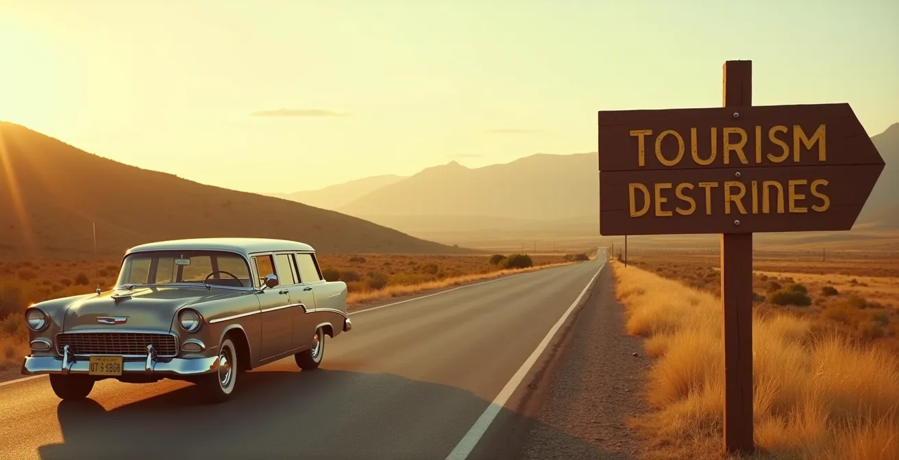
You’ve seen it a hundred times. A faded, hand-painted sign for “World Famous Pie” flashes by at 70 miles per hour. A narrow dirt road veers off into a dense forest. For a split second, you wonder, “What’s down there?” Then, the moment passes. You’re still on the interstate, on schedule, but a quiet feeling of missed opportunity lingers. You want to be spontaneous, but you end up sticking to the plan, driving right past the very adventures you set out to find. The romance of the open road is an industry in itself, with over 1.90 billion road trips taken in 2023 and 2024 expected to set new records.
The common advice is to “get off the beaten path” or “talk to locals,” but this guidance is frustratingly vague. It’s a mindset, not a method. How do you know which path to get off on? What do you even ask a local that doesn’t just lead you to the same place every other tourist goes? You can scroll through apps and blogs, but they often highlight the same dozen “hidden” spots until they’re not hidden anymore.
But what if the real secret wasn’t about finding a better app, but about becoming a better observer? What if true discovery came from mastering the art of signal reading—learning to interpret the subtle, real-world cues that point toward authentic experiences the internet doesn’t know about yet? It’s a shift from passively hoping for serendipity to actively creating it.
This guide provides a practical framework for that skill. We’ll explore how to decode the landscape, from mysterious brown signs to the nuances of a gas station conversation. You’ll learn how to use digital tools like a professional scout and, most importantly, how to redefine success to make every journey richer, whether you arrive on time or not.
This article provides a complete system for transforming your road trips from a straight line into a web of memorable discoveries. We will cover everything from interpreting roadside signage to the philosophy of a truly successful journey.
Summary: A Guide to Unplanned Discovery on the Road
- Why Brown Signs Are Usually Worth a Detour?
- How to Ask Gas Station Attendants for the Real Local Spots?
- The Detour Dilemma: When is a Side Trip Worth Delaying Arrival?
- The Billboard Mistake: How to Spot Fake Attractions from the Highway?
- How to Use Satellite View to Spot Swimming Holes Near the Road?
- How to Download Huge Map Areas Before You Lose Signal?
- How to Scout Unique Viewpoints That Aren’t Swarmed by Influencers?
- What Defines a Successful Road Trip and How to Achieve It?
Why Brown Signs Are Usually Worth a Detour?
The brown rectangular signs you see along the highway are more than just markers; they are the official language of serendipity. Governed by the Manual on Uniform Traffic Control Devices (MUTCD), these signs indicate recreational or cultural points of interest. Unlike commercial billboards, they are non-promotional. An attraction has to meet specific criteria to earn one, meaning a brown sign is a baseline indicator of quality or significance. It’s the first and most reliable signal that something noteworthy is nearby.
However, not all brown signs are created equal. The key is to practice signal reading. A sign for a National Park is a major commitment, while one for a “Scenic Byway” or “Artisan Trail” points to a more contained, often more unique, local experience. These are often the veins of gold. The real magic happens when you apply the “Second Click Strategy”: don’t just follow the sign to its destination. Before you even turn off the highway, pull over and check your satellite view. The sign’s destination might be interesting, but the small lake just past it, or the cluster of old buildings nearby, could be the true hidden gem.
Think of each brown sign as an invitation, not a command. Some lead to sprawling parks, others to a single, fascinating historical marker. The trick is to develop a quick assessment habit. If a sign points to something just a few miles off your route, consider the 15-minute exploration rule: if you can get there, look around, and get back on your way in about fifteen minutes, it’s almost always worth the stop. These small investments of time are what build a trip rich with discovery.
How to Ask Gas Station Attendants for the Real Local Spots?
Your GPS knows the fastest route, but the person behind the counter at a rural gas station knows the best route. Gas stations are the unsung epicenters of local knowledge. They are neutral grounds where truckers, farmers, and locals intersect. But getting the real information requires a strategy beyond “what’s good around here?” That question gets you the tourist answer. To find the true gems, you need to ask more personal, specific questions.
Instead of a generic query, try something like, “Where do you grab lunch when you want to get away from it all?” or “I’m looking for a place with a bit of a weird story, anything like that nearby?” This reframing shifts the dynamic from a tourist transaction to a human conversation. You’re not asking for a recommendation; you’re asking for a piece of their life. As a case in point, some of the nation’s most acclaimed food is hiding in plain sight. Miami’s El Carajo serves world-class Spanish tapas inside a working gas station, while the Whoa Nellie Deli at a Mobil station near Yosemite has earned national praise for its gourmet dishes. These spots are rarely advertised because they don’t have to be.

The source of the information matters, too. Aim for the older, long-term employees who have seen the town change, not the seasonal worker on their first week. They are the keepers of the local lore. If you can, visit during a shift change when multiple employees might be present, giving you a chance to cross-reference recommendations. If two or three people independently mention the same unassuming diner or that strange sculpture down a backroad, you haven’t just found a point of interest—you’ve found the local consensus. That’s gold.
The Detour Dilemma: When is a Side Trip Worth Delaying Arrival?
Every promising dirt road presents a conflict: the thrill of the unknown versus the tyranny of the schedule. Arriving at your hotel before check-in, meeting friends at a specific time—these are powerful anchors. But the most memorable moments of a road trip are almost never the planned arrivals. They are the unexpected discoveries made in the spaces between. To navigate this, you need a mental framework, a “Detour Calculus,” to make quick, confident decisions.
This isn’t about complex math; it’s a simple, powerful thought experiment. When faced with a potential detour, don’t ask, “Will this make me late?” Instead, ask the question posed by the “Regret Minimization Framework” of road trip philosophy. It’s a lens that clarifies what truly matters in the grand scheme of your travels.
In 10 years, will I regret more arriving two hours late, or not knowing what was down that intriguing dirt road?
– Regret Minimization Framework, Solo Traveler World Road Trip Philosophy
This question cuts through the noise of short-term logistics. The answer is almost always the same: you will not remember arriving on time, but you will forever wonder about the road not taken. This doesn’t mean every detour is mandatory. The calculus involves a quick assessment. Is the potential reward high? (e.g., a sign for a waterfall vs. a sign for a factory outlet). Is the time investment reasonable? A 30-minute side trip is an easy “yes.” A three-hour one requires more consideration. The goal is to make a conscious choice based on long-term memory value, not short-term convenience.
The Billboard Mistake: How to Spot Fake Attractions from the Highway?
Not all roadside signals lead to treasure. For every authentic local gem, there are a dozen tourist traps, and their primary language is the billboard. Learning to read the signals on these massive signs is your best “Authenticity Filter” to avoid wasting time and money on manufactured fun. The biggest red flag is volume. If you see one billboard for a “Mystery Spot,” you might be onto something. If you see fifty of them over a hundred miles, you’re being funneled into a commercial enterprise designed to separate you from your cash.
Another key signal is the language used. Authentic attractions tend to use simple, factual descriptions (“Historic Mill,” “State Park”). Tourist traps scream with superlatives: “World’s Best!,” “America’s Greatest!,” “You Won’t Believe Your Eyes!” They sell the sizzle, not the steak, because the steak is often disappointing. A cartoon mascot, excessive neon colors, and a heavy focus on gift shops in their advertising are all strong indicators of a trap.
To master this skill, it’s helpful to understand the key differences between a genuine discovery and a manufactured one. An analysis of countless roadside stops provides clear authenticity filters:
| Indicator | Hidden Gem Signs | Tourist Trap Red Flags |
|---|---|---|
| Signage | Single understated sign, minimal advertising | 50+ billboards over many miles |
| Language | Simple factual descriptions | Excessive superlatives (‘World’s Best!’, ‘America’s Greatest!’) |
| Distance-to-Hype Ratio | Nearby attractions with modest claims | 100+ mile advance advertising |
| Visual Elements | Natural photography, historical images | Cartoon mascots, neon colors |
| Reviews Focus | 3-star reviews mention authentic experience | Reviews warn of overpricing and disappointment |
One of the most powerful and counter-intuitive filters is to look at the 3-star reviews online. Five-star reviews can be fake or from easily impressed visitors. One-star reviews are often from perpetually grumpy people. The three-star reviews are where you find the truth. If a reviewer says, “It was a bit rustic and there wasn’t much to do, but the old guy who runs it told us some amazing stories,” you’ve probably found a gem. If they say, “It was smaller than the billboards made it look and everything cost extra,” you’ve found a trap.
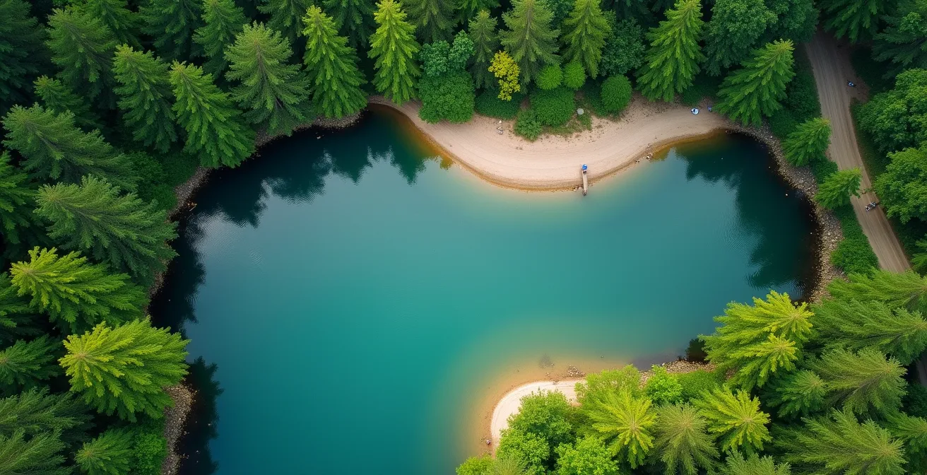
How to Use Satellite View to Spot Swimming Holes Near the Road?
Some of the best hidden gems aren’t advertised at all. Secluded swimming holes, forgotten ruins, and breathtaking clearings are often invisible from the road, but they can’t hide from a satellite. Using map apps in satellite mode is like having a superpower, allowing you to scout the landscape for promising features. The key is to look for specific patterns and signatures in the terrain.
Start by tracing the path of any river or creek that runs near your route. Look for sharp bends in the water, as these often create deeper pools and sandy or gravelly banks—the classic signature of a natural swimming hole. Pay attention to the color of the water; a brighter turquoise or deep blue can indicate depth and clarity. You should also look for informal trails. A thin, unofficial-looking dirt path leading from the road to the river is a telltale sign that people have been going there for years. These “ghost trails” are rarely on official maps but show up clearly on satellite imagery.
Successful digital scouting often involves a “Map Layering” strategy, as advanced road trippers combine multiple tools for a complete picture. You can start with Google Maps for a general satellite overview, then switch to apps like iOverlander or The Outbound Collective, which feature user-generated GPS coordinates for water access points and campsites. For more serious exploration, tools like Gaia GPS offer detailed topographical maps that show elevation changes—critical for finding waterfalls and the natural pools they create. By cross-referencing these layers, you can confirm a promising spot and find the best way to access it, turning a digital hunch into a real-world discovery.
How to Download Huge Map Areas Before You Lose Signal?
Your ability to read digital signals is useless if you don’t have a signal. The most interesting places are almost by definition outside the reach of cell towers. Preparing for this inevitability is non-negotiable for any serious explorer. While 93% of American travelers had trip plans within six months as of January 2024, with most relying on digital tools, many forget that connectivity is not a given. The solution is a robust, multi-layered offline map strategy that ensures you’re never truly lost.
Don’t just download one massive map; think in layers, each serving a different purpose. This approach provides redundancy and a richer set of data than any single app can offer.
- Layer 1: The Base Map (Google Maps). Before you leave, use Google Maps’ offline feature. A pro tip is to download maps by county or region rather than entire states. This is far more manageable for your phone’s storage and ensures you get the necessary detail without downloading data you’ll never use.
- Layer 2: The Detail Map (Maps.me / Organic Maps). Install a secondary app like Maps.me or its open-source successor, Organic Maps. These apps use OpenStreetMap data, which is often far more detailed for trails, footpaths, and obscure points of interest that Google omits. Their offline maps are incredibly comprehensive.
- Layer 3: The Specialist Map (Gaia GPS / Avenza). For backcountry exploration, add a specialized app. Gaia GPS is the standard for topographical maps, showing you the contours of the land. Avenza Maps allows you to download official forestry, park, and recreational maps that function with your phone’s GPS.
- Layer 4: The Analog Failsafe (Paper Map). The ultimate backup. A physical paper road atlas never runs out of battery. It gives you a big-picture perspective that a small screen can’t and is an invaluable tool for planning and re-routing when all else fails.
Managing storage is key. If your device has an SD card slot, dedicate it to map storage. Periodically clear the cache of areas you’ve already visited to free up space for the road ahead. This layered strategy turns your phone from a dependency into a powerful, self-reliant exploration tool.
How to Scout Unique Viewpoints That Aren’t Swarmed by Influencers?
You’ve seen the photos: a lone figure perched on a dramatic cliff, staring into a perfect sunset. You drive to that exact spot, only to find a queue of 50 people waiting to take the same picture. The most famous viewpoints have become victims of their own popularity. But for every iconic, overcrowded vista, there are a dozen equally stunning alternatives nearby, waiting to be discovered by those willing to think differently.
The most powerful advanced technique is the “Reverse Viewpoint” strategy. Instead of going to the famous spot, use a terrain map (like Gaia GPS or Google Earth) to identify the publicly accessible ridges or hills that face it. This approach, used by landscape photographers to find unique compositions, offers a completely new perspective. Imagine capturing a photo of Utah’s Delicate Arch that not only frames the arch beautifully but also includes the crowded main viewpoint in the distance, creating a more interesting and honest story of the place.
Another method is a form of digital archaeology. Before Instagram, photographers shared their work on sites like Flickr and 500px, often with geotags. Use these platforms to search for your destination, but filter the results for photos uploaded 5-10 years ago. You’ll uncover a visual record of the area before certain spots went viral. Cross-reference these old, geotagged images with satellite maps to pinpoint locations that have since been forgotten. Old travel forums from photography or hiking communities are also treasure troves of this “pre-viral” information. Finally, if you must visit a popular spot, use the time-shift strategy: be there at the extremes of the day. The “golden hour” right after sunrise or the “blue hour” just after sunset are often empty, as most tourists and influencers are either still in bed or heading to dinner.
Key takeaways
- The Detour Calculus: Weigh the long-term regret of a missed experience against the short-term inconvenience of a delay.
- The Authenticity Filter: Differentiate real gems from tourist traps by analyzing the language, volume, and honesty of their advertising.
- The Map Layering Strategy: Combine multiple digital and physical maps to create a redundant and deeply detailed navigation system that works anywhere.
What Defines a Successful Road Trip and How to Achieve It?
It’s easy to fall into the trap of measuring a road trip by its efficiency: miles covered, destinations ticked off a list, arriving on schedule. But this mindset turns a journey of discovery into a logistics exercise. A truly successful road trip has a different metric of success, one that prioritizes experience over distance. It’s a fundamental shift in perspective that changes everything about how you travel.
This new philosophy redefines the goal. The objective is not to get from Point A to Point B. The objective is to collect as many quality stories as possible along the way. A “failed” detour that leads to a dead end but a funny encounter with a local farmer is not a failure; it’s a success. It’s a story. This “Story-Collecting Mindset” is becoming more prevalent as travelers seek deeper connections, a trend reflected in recent data showing that 70% of Americans plan to maintain or increase travel in 2025, with a growing focus on multi-generational and “slow travel” experiences.
Success isn’t reaching Point B. It’s about the number of quality stories you collect along the way
– Road Trip Philosophy, The Memory-per-Mile Concept
Achieving this requires a conscious effort to embrace imperfection and prioritize human connection. It means allowing a spontaneous stop to derail your schedule for an hour or two because it’s yielding a genuine experience. It means valuing the three genuine conversations you have with locals more than the 300 miles you cover in a day. By adopting this framework, you free yourself from the anxiety of the clock and open yourself up to the world of possibilities you were speeding past.
Your Action Plan: The Story-Collecting Mindset Framework
- Redefine success as memories-per-mile rather than miles-per-gallon efficiency.
- Embrace “failed” detours as essential parts of the exploration process and raw material for future funny stories.
- Make it a goal to document at least 3-5 genuine conversations with locals per day of travel.
- Allow spontaneous stops to extend beyond their planned time if they are yielding unique experiences or stories.
- Measure your trip’s success by its density of unique experiences, not by the distance you covered on the map.
By adopting these strategies—from reading the subtle signals of the road to fundamentally changing your definition of success—you transform every drive into an opportunity for genuine adventure. Start applying this framework on your next trip and watch the world open up.